| « Configuring Postfix to accept client certificates | Importing and exporting Firefox certificates from the command line » |
Digikam and geotagging
Monday, January 3, 2011
Digikam is probably one of my favorite programs that I use on a regular basis. It's got all the regular digital photo album functionality, as well as some cool extras like lens distortion correction, a pretty cool bulk renamer, and import/export for Picasa, Facebook, and others. I think the coolest is geotagging — recording latitude/longitude coordinates in photos. A few years ago this wasn't very popular with casual photographers, since it requires carrying around a GPS device. But today, many smartphones, and even some non-phone cameras, have built-in GPS receivers that automatically record location information with each photo taken. And even if your camera doesn't have GPS integrated, it's easy to use a free GPS logger app to record where you've been and later use software to correlate the GPS log with your photo timestamps.
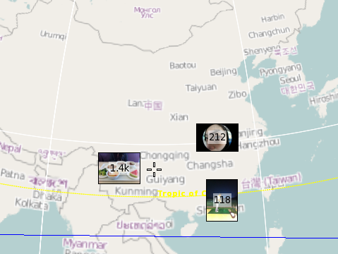
Once your photos are geotagged, you can search for all the pictures you've taken in a particular area. It looks like I've taken 212 photos in the city of Wuhan, for example.
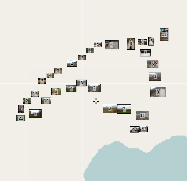
Also, you can take a look at a group of pictures (e.g. from a particular day) and see where they were taken. These photos were from riding a horse on a rural mountain trail for a few hours. (The map is blank because it's rural China — no data here.)
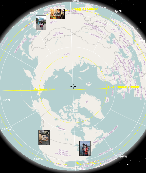
Or do an arbitrary search and see where the photos were taken. Here are all my geotagged photos of Handi:
Modern technology is pretty awesome.
Comments
There are no comments.
Add a comment

Archives
2024
- September (1)
- March (1)
2023
- April (1)
2021
- February (2)
2020
- March (1)
- January (1)
2018
- April (1)
- March (1)
2017
- February (1)
2015
- March (1)
2014
- June (1)
- May (1)
- March (1)
2013
- December (1)
- May (1)
- April (1)
- March (2)
2012
- December (1)
- September (1)
- August (3)
- July (1)
- February (1)
- January (1)
2011
- December (1)
- June (1)
- April (1)
- March (1)
- January (2)
2010
- December (1)
- November (4)
- October (1)
- June (2)
- May (1)
- March (1)
- February (2)
- January (2)
2009
- December (4)